The Morning Times, Cripple Creek, Colorado.
Sunday Morning, December 31, 1899.
(page 13; but marked as page 9)
Source had no images, so I used some images from my collection.
DEVELOPMENT OF THE MINES
By Unknown
During the first five years in the history of the camp—from 1891 to 1896—there was much speculation as to the perpetuity of the ore bodies. Experts of wide reputation in the mining world, drawing their conclusions from experience in the great gold mining centers of the five continents, pronounced the deposits of the Cripple Creek district as superficial. It was this uncertainty that delayed development. However, men not familiar with the rules by which mining in other sections was conducted persisted in their belief that the experts were wrong, and that they were right.
This latter class represented the brawn and muscle, and their experience grew out of an intimate knowledge which they were daily acquiring as to the formation, and the productive values they encountered. So long as they saw the ore chute this followed without regard to the experts' testimony. The men who spent their time at Colorado Springs derided the efforts that were being made to make a mining camp out of a cow pasture. To these prospectors is due to-day the prosperity of this district. If they, like the investor, had been influenced by the statements of supposed scientific men, the camp would still have been in embryo. But they toiled alone, developing their properties, and day by day proving to the world that underneath the grass roots lay fabulous riches.

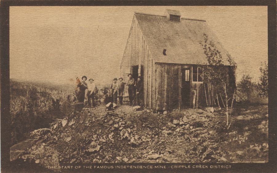
The Start of the Famous Independence Mine.
Side by side with these men, worked the experimenters in the chemical processes, and as the prospectors developed the ore, these experimenters applied their scientific theories with marked success. Experiments in the low grade ores of Southern California, in the Floyd and Mercur districts of Utah, in the infant region of South Africa, in Australia and elsewhere, were being applied to the reduction of the eruptive formation of which this camp is composed. Side by side with development in the district, the processes of treatment improved and became a potential factor in the district's development.

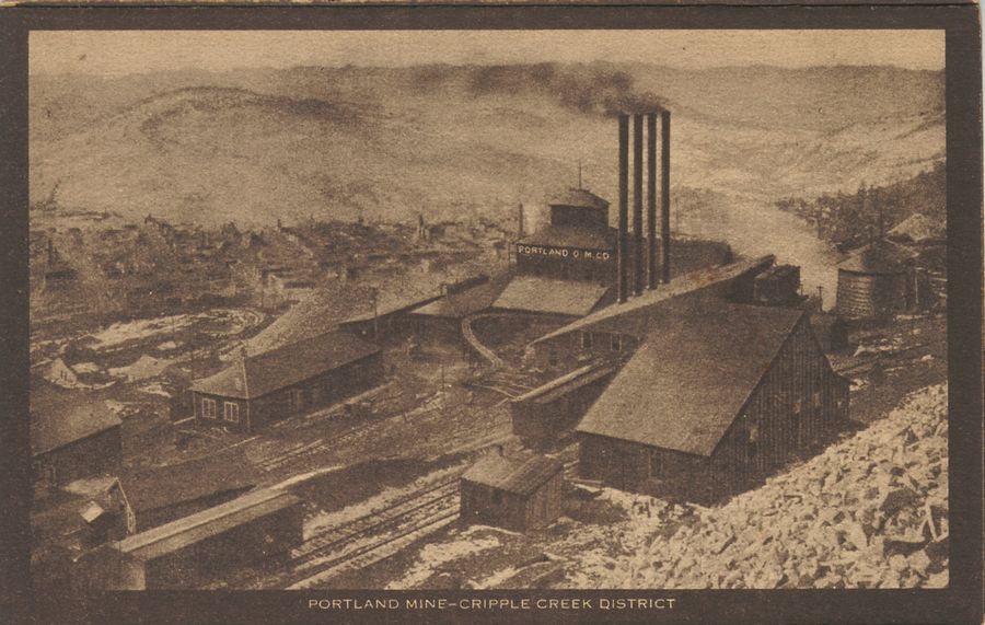
View down at the Portland Mine.
As the discovery shafts with their windlasses developed into mines with horse and steam power, the values increased, so that it soon became demonstrated that with depth the district would prove all that the most sanguine had anticipated. Deep mining then became the factor, and the prospector soon acquired a wider knowledge of the treasures confined in the calaverite deposits. They no longer sought the superficial bodies of oxidized ore, but learned to look upon these as merely an indication of the greater wealth that lay below. The stamp mills which were constructed to treat the free milling dirt, soon went out of existence, and in their places came the reduction works with their roasters, crushes and vats.

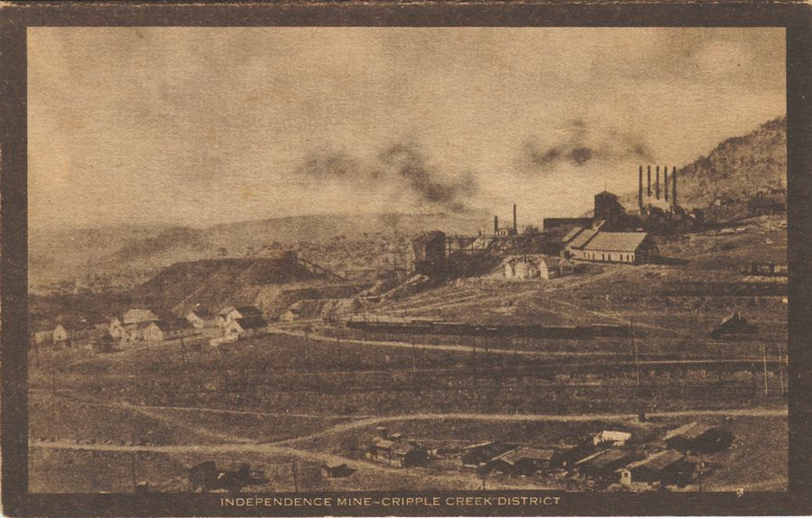
Independence Mine.
With the discovery of sylvanite in the C. O. D. the new era had come upon the camp. With these deposits are here found such a great number of veins and dykes that they form an intricate network throughout the entire area of the district. The veins are absolutely without number, and have every conceivable course and dip. The only condition approaching a system is that the majority if not all, of the larger veins have a trend rather nearer to north and south than to east and west, and the number of veins running northeast and those running northwest are about equal. The number of veins are so great that the miner who goes to search for the extension of a rich vein on an adjoining property often finds a new vein instead of the one for which he was searching. This intricate vein system is the unique feature of the district.
The most interesting feature in connection with these veins, both from a scientific and from a practical standpoint, which has not heretofore been recognized, is the existence of a horizontal leached zone. This is demonstrated in the tunnel work, the tunnels without a single exception being run into the hills upon this barren zone, and while rich producing mines are operating above the floor of the tunnel, the chute encountered at the breast of the bore, as a rule, produces no value.
To reach gold deposits by way of a tunnel, it is demonstrated that development must be either through an upraise, or by winze, following the vein until the ore chute is again encountered at a lower depth. The explanation seems to be that the leaching process, acting out of the reach of the cooling influence of the surface has extracted the values and redeposited the same at a greater depth, possibly at some ancient low water line. The boundary between the leached zone and the lower pay zone is more variable than that dividing the upper valuable deposit.
Dr. R. A. F. Penrose, in his report of 1894, published by the government, says that this; like all useful rules, has its exceptions, which seem to be quite contradictory, but the theory is supported by the conditions in so many of the mines, and in the different kinds of rock, that it is certainly worthy of the most careful study. It was the early recognition of this peculiarity in the formation, demonstrated by the tunnel work, that led the mine owners to drive their shafts as deeply as possible below the barren zone. The practical man, passing by the scientific conclusions, makes a study of the shaft development. In this respect the average reader can more readily acquire information as to the extent that has been obtained by the district in its work of outputting gold values, and, for their information, we furnish a list of the shafts with the depth of each: Considering their number and the age of the district, they make a most striking exhibit.
The figures represent the present depth in feet:
| Anna Lee—Portland Co. |
732 |
| Buena Vista—Isabella Co. |
1,000 |
| Burns shaft—Portland Co. |
1,000 |
| Hull City—Montgomery shaft |
600 |
| Lee shaft—Isabella Co. |
900 |
| Pharmacist—Jones shaft |
440 |
| Plymouth Rock—Crater Co. |
1,030 |
An interesting feature in the tunnel development is produced in the following (length in feet):
| Chicago-Cripple Creek |
2,300 |
| Columbine-Victor (west end) |
2,700 |
| Cripple Creek and Gold Hill |
3,200 |


