acting just like a spacer
type of text in order to
push the Entity info
down on the page. Sorry to have wasted your time/ear to listen to this, I was just trying to get a layout work like I wanted.
30.03.2013
A long overdue update to say model is available for Trainz. Model can now be found and downloaded from the Trainz Download Station - Look up KUID2:77573:25023:1. Or use my main Downloads page (TRS2004 or newer only) for a link to the file at the Trainz Download Station.
Or, you can just click here on this Direct Link, need Download Helper and installs direct into Trainz, or Content Manager if TRS2006 or newer.
25.11.2006
After finally getting some broadband Internet where I am now mostly located, I have had the chance to go back to the newspaper site and do some more reading & looking for various tidbits of nice to know info. And, while haunting for info about Gold Coin Mine I found this little bit about the Bolivia Mine:
Work on the Bolivia - The machinery on the Bolivia claim of the Dorcas company, is being overhauled and operations will be resumed there by the first of the month. More work has been done on that property than any property outside of the production belt.
07.10.2006
Earlier this year I bought some older Engineering & Mining Journals from 1903 - not the best shapes, but I still get some info out of them.
And lo and behold, in a issue dated January 10, 1903 I actually found what believe is the latest news & fate of this mine! A news info said the following:
1903 Jan 10
Bolivia - The surface plant, including a compressor, burned down recently. The property is near the town of Gilette. Considerable work was done some time ago, but no ore of any value was found. The property belongs to the Dorcas Mining and Milling Company.
So I guess the skeptical I could read out of earlier reports regarding this mine was correct. It is sad in a way though, as there where real men (& woman most likely) behind this mine, with high hopes for a better future. But such is life, mining can and is very hard, and not so many find the bonanza they all look for.
22.01.2006
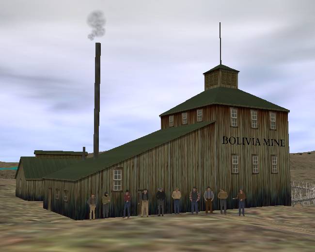
Thanks to my model and sort of new found interest of digging up info (kind of easier to do that then dig gold when using a computer... LOL) I have some more info about the Bolivia Mine. I also have added a screenshot from inside Trainz of this mine, at it's estimated location in the District.
But, first, the info I dug up, all from the same website and newspaper as I found the article that made this mine possible in:
Work on the Bolivia
Steam Plant and Air Drills Being Put on By the Company.
A plant of machinery consisting of a 50-horse power boiler, a 40-horse power hoist, and two air drills is being placed on the Bolivia claim, owned and operated by the Dorcas company.
The Bolivia is located about a mile this side of Gillett, just below the Lincoln mine.
The development work already done consists of a shaft 100 feet in depth. The shaft is vertical, and is calculated to cut the vein at a depth of 200 feet.
The vein on the surface made a showing which the company thought justified a deep shaft and a plant of machinery.
Big Ore Lies Ahead
Bolivia Will Now Go to 700 feet.
What The Diamond Shows
Three Hundred Feet Below The Present Depth There Is Marvelously Rich Ore - Will Sink For It
On the Bolivia mine, near Gillett, it has been determined that there is a body of immensely rich ore at a point 300 feet below the present bottom of the shaft.
How large a body it is cannot yet be determined, but it is there, and it is rich.
The company will now sink the shaft to a depth of 700 feet and get at it. The company has for some time been exploiting the rock below the bottom of the shaft, which is 400 feet deep, with diamond prospecting drills.
A few days ago the core showed that the drill had entered a body of enormously rich sylvanite. Of course there is no means of knowing how wide the chute is, but the management, being sure that high values are to be found, will at once put the shaft down another 300 feet to catch the ore.
The Bolivia is well known as a mine which has a big steam hoisting plant, air compressors and machine drills, and never a pound of ore.
The claim lies about a mile and a half to the west of Gillett, and nowhere near any of the big producers. The company has plenty of money back of it, and can easily sink the shaft to the required depth.
If the ore body proves to be extensive, the result will be another appreciable widening of the recognized gold belt of the Cripple Creek district.
Three Shifts At Work
How the Bolivia is Now Being Developed.
Claim Great Ore At Depth
Said To Be Have Found With A Diamond Drill - Other Properties Adjoining The Bolivia Preparing To Put On Heavy Machinery.
The way things are humming at the Bolivia, on Galena hill, is almost positive proof that the story that has been current for several weeks to the effect [?] that the diamond drill used there for some time had cut into a big body of high grade ore was absolutely true.
All that the local management will say is that instructions are being followed, but add they expect to be shipping plenty of ore before the end of the year.
Just at what depth pay was found with the diamond drill cannot be learned.
Forty-two Feet Of Ore That Will Pay
What the Diamond Drill Is Credited With Finding in Bolivia Ground.
Three shifts of men are driving a cross-cut east as rapidly as possible from the bottom of the Bolivia shaft on Galena hill. The depth of the shaft is 420 feet.
From what is believed to be a perfectly reliable source, The Times learns that the diamond drill that was used in prospecting the property was started west at first and driven for 300 feet, but at no place did the core show any values.
Then it was started directly east and before it stopped had gained a distance of 320 feet. At 250 feet pay was found, and according to the core 42 feet of ore was passed through before country rock was again encountered.
On this enormous body it is positively asserted that no assay under $14 was ever had, and from that on up as high as $64. One man not connected with the company got a piece of the core, and his assay showed a value of $20 to the ton.
Of course, until the vein is cut, it will be impossible to tell the width of the fissure, as it is possible that the diamond drill, instead of passing through the ore at right angles might have run almost with the vein.
In any event, however, it is probable now that the Bolivia may become a great property.
As the company now operating it has already spent a little more then $90000 on it, they are certainly entitled to a mine, and if they get it, how all the country north of Cripple Creek will boom!
Only things I now find is some text under a "sales pitch" for how great Gillett is, about how the manager of the Bolivia mine in spite of not having to much luck still keeps digging as he knows there are great values down below. And how he have hopes for other companies to help in covering the expanses for dewatering - which sort of indicates a water problem.
Also, another place in that issue I find a list over depths the mines has reached, the Bolivia is mention having a depth of 420 feet.
Only thing I could find was that Bolivia is mention on the list over mines and their depth, still listed as having a depth of 420 feet. Which to me indicates things are not going very well...
This is the last I can find, but the online newspapers database is only reaching to march 1900 and only for one of the many newspapers in the District so stuff might show up to my attention down the road...
Under a heading called "Colorado News Items" this short noticed showed up - and I include it here as I sort of thought it might be fitted to this mine...:
J.M. Hower, general manager of the Dorcas Mining, Milling & Development Company, died at Florence on the 9th inst. of pneumonia, at the age of sixty-seven years. He had recently returned from a trip to Nevada.
21.01.2006

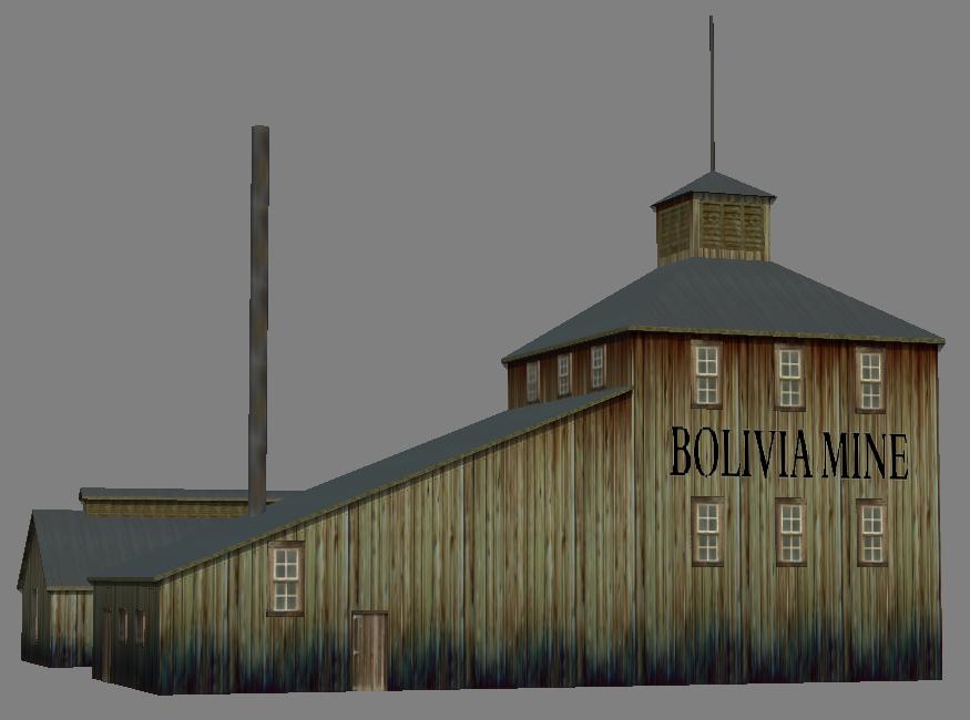
The Model in a mesh viewer.
Thanks to a nice website featuring old newspaper issues and allowing online searches/viewing I was able to find my self a nice and easy little project for 1 more mine related to the Cripple Creek District!
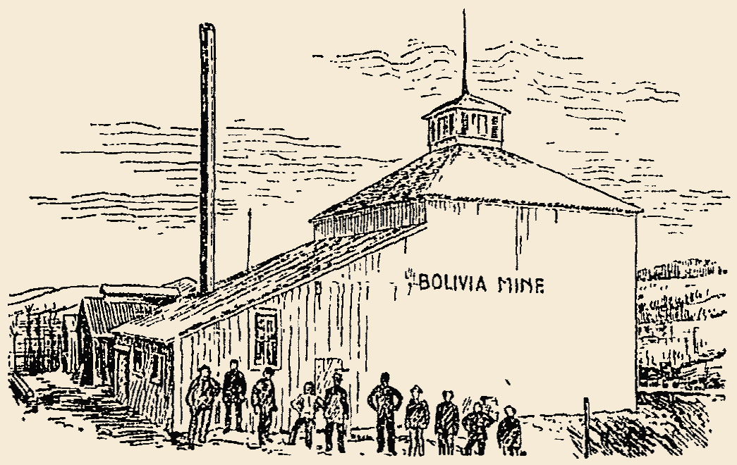
I didn't find allot of information, but the article I saw had a line drawing in it and I used that for the inspiration for this mine. It did also help that the article mention the size of the structure of course. LOL - I've rewritten the article below here BTW:
Bolivia Mine
Operations of James Parfet and His Associates, near Gillett, Colorado.
The Dorcas Mining, Milling and Development Co. was organized in August 1897 with Frank B. Hower as president. J.M. Hower, Jr as secretary and treasurer. The board of directors are Frank B. Hower, J.M. Hower, Messrs. Burnes, Taylor and James Parfet.
The property of the company consists of five patented claims. - The Phoenix, Bolivia, St. Joseph, John Kyle and Gurley, besides the Summit tunnel now in 400 feet, and six claims now undergoing patent.

The Bolivia group consists of the Bolivia, Phoenix and St. Joseph, laying side by side, making up a block of ground nearly 1500 feet long by 900 feet wide. The Bolivia is the central claim, and the principal work is now being done on this claim.
Active work was begun in September, and there is now on the property a large and conveniently arranged shaft house 30x70 feet with a large well-heated changing room for the men, together with a large blacksmith shop, with compressed air blast, an oil house and powder magazine warmed up with steam.
The machinery consists of a double 7x10 Fairbanks-Morse hoist and a 50-horse boiler, together with a 12x12 Norwalk compound air compressor with four power drills. A number seven Cameron pump on the ground is capable of handling the water to the depth of 400 feet.
The underground work consists of a well-timbered shaft 200 feet in depth, where the second station is now being cut. At the 100-foot level a substantial station was put in and cross-cuts driven 82 feet to the east and 58 [?] feet at the west.
Five well-defined veins have been exposed, ranging from 2 to 12 feet in width, and assaying from $8 to $20 per ton. In the shaft at 85 feet from the surface a phonolite dyke six feet in thickness was cut, showing a nice contact vein on both sides. This dyke was comparatively flat and dipped to the west.
At 130 feet the second dyke was cut. This dyke, with it's vein matter, was 20 feet thick. Good assays where taken at this point.
It is the intention pf the company to again cut this dyke by a cross-cut at the 200-foot level. Very little water has as yet been encountered in the mine.
The Kyle and Gurley are the two most promising claims on the hill, and show more float on the surface than can be found on any other portion of the hill. This float shows an average value of $8.
A vertical shaft 80 feet deep was sunk on the Gurley, cutting through the phonolite at the depth of 35 feet. No cross-cutting was done below this point.
The Summit tunnel is situated on the east side of Trachyte Mountain, and is being driven in a westerly direction through the center of the mountain, and has a vertical depth at the center of nearly 1000 feet.
Few properties in the entire District have more favorable indications for the amount of work done, and it will, Indeed, be a surprise if the Bolivia will not be ranked among the big producers in the year 1898.
Judging by the equipment and the manner in which the work is being done, the company have every confidence in their property, and are determined to thoroughly test it at the shortest possible time.
The mines are in charge of James Parfet, a man of large experience, and known all over the west as a thorough and competent mine manager.

Model as seen in Trainz

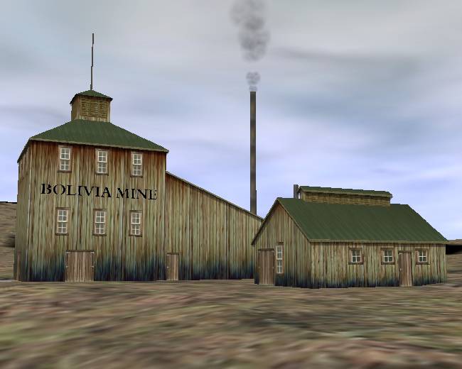
The Model in Trainz as seen from "The Other Side"
Thanks to that article I was able to make my self a pretty nice and large but still a small mine structure that might be useful for more then the one location it should be at. Except that I don't know where it should be located as I have no other record of a Bolivia Mine.
My 1902 map has no mention of this mine, but I have a Bolivar Mine mention there, and the location is near Gillett so I sort of suspect it might be the same mine. So, until I find other info/evidence, that is where this mine will first be located. LOL
As the article did not mention the size of the blacksmith, or any other structures, and the line drawing only show me two sides I had to guess about the rest of the stuff - but I think the end result was not that bad. :-)
For those into Trainz/3D modeling, this model is now standing at 513 polygons as there are quite many windows in it (pure guesswork most of them) but I did add a LOD (Level Of Detail) level to it and that stands at "only" 321 polygons as soon as you get about 25-50 meters away from center of the structure. I was also thinking about adding the cables that help support the smokestack - but I will leave them off now as I'm tired of this mine now.
- Morning Times 01 Jan 1898 (p20) - from the Colorado's Historic Newspaper Collection website
- Colorado's Historic Newspaper Collection, various Newspapers & issues.
- Engineering & Mining Journal, January 10, 1903 edition - my collection.
All copying, hot linking, Whatever, should be sought permission for, Before doing it!
If you see something that should not be here, is wrongly marked, or have anything to add, please write me.